At DKX, we strive to provide pilots with a safe and friendly airport experience. As an entry point to our beautiful city, the airport offers the chance for pilots to fly-in and explore by offering pilots the information and resources they need to navigate the airspace and community around DKX. The following items highlight the features and amenities available at DKX that will make your next visit safe and convenient. Please notify our staff if you have any questions at dkx@tys.org.
NOTAMs

Noise Abatement Procedures
Within the air space surrounding DKX are noise sensitive areas as we work to continue to be a good community partner. The following noise abatement procedures are in place for DKX:
- Runway 08 is the preferred calm wind runway.
- Aircraft departing Runway 26 should avoid turns over the neighborhood located approximately 1 NM southwest of the airport.
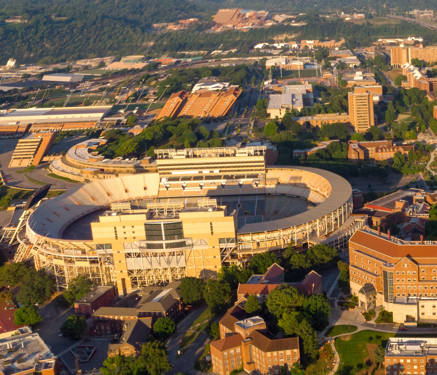
Game Day TFR
DKX is a non-towered airport. Due to security concerns during University of Tennessee (UT) home football games, there will be a Temporary Flight Restriction (TFR) in place during all UT home football games.
- FDC NOTAM 9/5151 outlining Temporary Flight Restrictions from one hour prior to game time until one hour after game completion will be in effect.
- The TFR fully encompasses the DKX airport.
- TFR information is available at http://tfr.faa.gov or the Flight Service.
- Aircraft inbound to the Knoxville, Tennessee, area should monitor the McGhee Tyson Airport ATIS on 128.35 for up-to-date information.
- If you plan to fly to DKX for any UT home football game, we recommend avoiding the TFR by arriving at DKX at least one hour prior to kickoff and departing at least one hour after the game ends.
Airfield
Runways 8 and 26
| RUNWAY 8 | RUNWAY 26 | |
|---|---|---|
| Dimensions: | 3499 x 75 ft. | 1066 x 23 m |
| Surface: | asphalt, in good condition | asphalt, in good condition |
| Weight bearing capacity: | Single wheel: 22 | Single wheel: 22 |
| Runway edge lights: | medium intensity | N/A |
| Latitude: | 35-57.755500N | 35-57.903043N |
| Longitude: | 083-52.762900W | 083-52.077207W |
| Elevation: | 833.0 ft. | 830.7 ft. |
| Traffic pattern: | left | left |
| Runway heading: | 080 magnetic, 075 true | 260 magnetic, 255 true |
| Markings: | nonprecision, in fair condition | nonprecision, in fair condition |
| Visual slope indicator: | 2-light PAPI on left (3.80 degrees glide path) | 2-light PAPI on left (3.35 degrees glide path) |
| Runway end identifier lights: | yes | yes |
| Touchdown point: | yes, no lights | yes, no lights |
| Instrument approach: | N/A | LOCALIZER |
For more detailed information, click here.
Weather Information
Need a Ride?
Need transportation when you arrive at DKX? Courtesy vehicles are available on a first-come, first-served basis for a maximum use of two hours. Contact (865) 577-4461 to reserve your ride.